Nearby Navigation Aids
| ID | Name | Freq | Radial | Range | |
|---|---|---|---|---|---|
 |
LFT | LAFAYETTE | 109.80 | 132° | 24.5 |
 |
LLA | WHITE LAKE | 110.40 | 064° | 39.6 |
|
LSU | FIGHTING TIGER | 116.50 | 202° | 40.1 |
|
TBD | TIBBY | 112.00 | 286° | 45.9 |
 |
AR | ACADI | 269 | 284° | 10.8 |
|
BNZ | ABBEVILLE | 230 | 288° | 25.7 |
|
LF | LAFFS | 375 | 327° | 26.5 |
|
FWX | NEW ROADS | 356 | 007° | 44.9 |
Nearby Airports with Instrument Procedures
| ID | Name | Heading | Distance | |
|---|---|---|---|---|
 |
KARA | Acadiana Regional Airport | 302° | 14.1 |
|
KPTN | Harry P Williams Memorial Airport | 119° | 20.5 |
|
KIYA | Abbeville Chris Crusta Memorial Airport | 277° | 22.3 |
|
KLFT | Lafayette Regional/Paul Fournet Field Airport | 313° | 24.8 |
|
KREG | Louisiana Regional Airport | 062° | 41.2 |
|
L83 | Thibodaux Municipal Airport | 097° | 44.4 |
|
KOPL | St Landry Parish-Ahart Field Airport | 326° | 45.4 |
|
KBTR | Baton Rouge Metropolitan, Ryan Field Airport | 031° | 46.5 |
|
KHZR | False River Regional Airport | 007° | 50.0 |
|
4R7 | Eunice Airport | 306° | 52.0 |
|
KHUM | Houma-Terrebonne Airport | 106° | 56.2 |
|
3R7 | Jennings Airport | 287° | 56.3 |
Chart Supplement
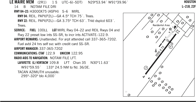
Click to enlarge
VFR Chart of 2R1
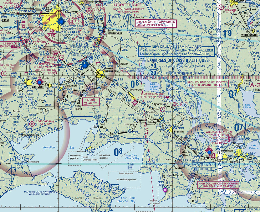
Click to enlarge
IFR Chart of 2R1
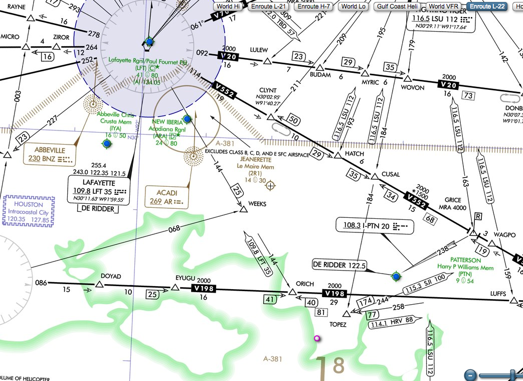
Click to enlarge
Satellite View of 2R1

Click to enlarge