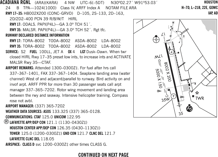
Nearby Navigation Aids
| ID | Name | Freq | Radial | Range | |
|---|---|---|---|---|---|
 |
LFT | LAFAYETTE | 109.80 | 145° | 10.9 |
 |
LLA | WHITE LAKE | 110.40 | 044° | 34.0 |
|
LSU | FIGHTING TIGER | 116.50 | 223° | 40.7 |
|
TBD | TIBBY | 112.00 | 290° | 59.4 |
 |
AR | ACADI | 269 | 167° | 5.0 |
|
BNZ | ABBEVILLE | 230 | 276° | 12.5 |
|
LF | LAFFS | 375 | 355° | 15.1 |
|
FWX | NEW ROADS | 356 | 029° | 41.1 |
Nearby Airports with Instrument Procedures
| ID | Name | Heading | Distance | |
|---|---|---|---|---|
 |
KIYA | Abbeville Chris Crusta Memorial Airport | 250° | 11.1 |
|
KLFT | Lafayette Regional/Paul Fournet Field Airport | 331° | 11.4 |
|
KOPL | St Landry Parish-Ahart Field Airport | 340° | 33.1 |
|
KPTN | Harry P Williams Memorial Airport | 124° | 34.6 |
|
4R7 | Eunice Airport | 312° | 38.0 |
|
3R7 | Jennings Airport | 286° | 42.9 |
|
KHZR | False River Regional Airport | 027° | 45.8 |
|
KBTR | Baton Rouge Metropolitan, Ryan Field Airport | 051° | 48.3 |
|
KREG | Louisiana Regional Airport | 080° | 49.8 |
|
6R1 | Welsh Airport | 284° | 50.8 |
|
L83 | Thibodaux Municipal Airport | 107° | 57.5 |
|
2R6 | Bunkie Municipal Airport | 341° | 57.9 |
Chart Supplement
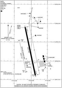
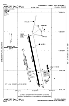
KARA Airport Diagram
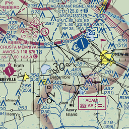
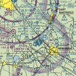
VFR Chart of KARA
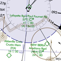
IFR Chart of KARA
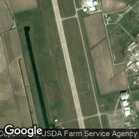
Satellite View of KARA
Click to Enlarge
Click to Enlarge